 CYGURU
In photographs 3 Photographs
Documented photographs from different dates. Open an image to browse the gallery and its original source.
 Enlarge photo ↗

 Enlarge photo ↗

 Enlarge photo ↗

In this guide · 6 sections
Recognise Phra Nang as a separate place
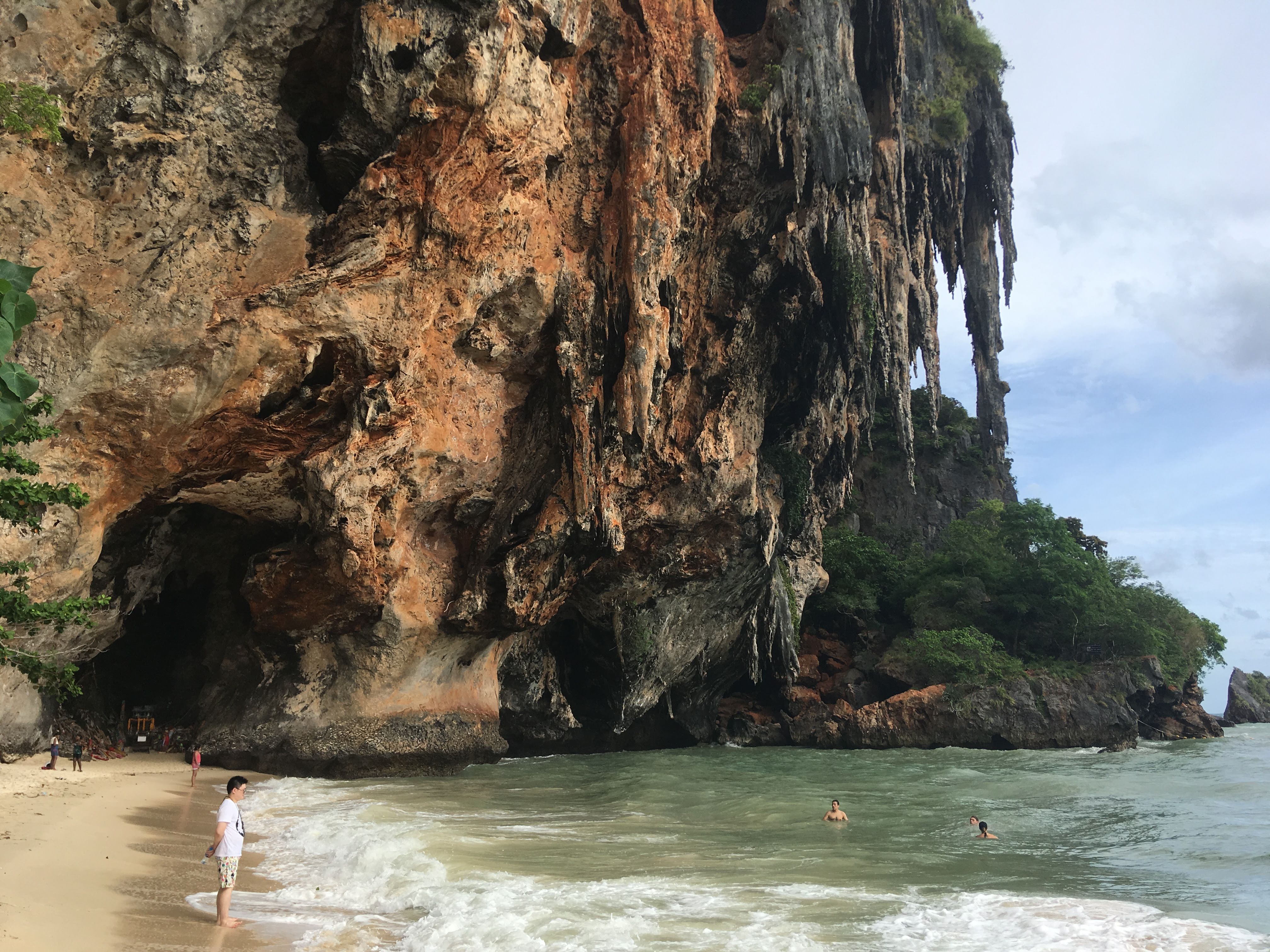
The Tourism Authority of Thailand describes Phranang Cave Beach as a beach and bay framed by limestone mountains and cliffs, with a cave at the end of the approach. It belongs in the Railay coastal landscape, but should not be confused with every beach carrying the Railay name.
Use the precise destination name when checking directions or arranging a meeting. If arriving elsewhere on the peninsula, establish the current walking route and allow time for the return. A general map search is an orientation tool, not a verified accessible path.
Look at the relationship between cave, cliff and sea
Begin with the wider setting before moving towards the cave area. The contrast between the pale sand, overhanging rock and water gives this stop a different character from an ordinary open beach. Choose a stopping place that does not obstruct other visitors or any locally protected space.
For photographs, consider the scale of the cliff as well as the beach itself. The documented image on this page was taken in 2012; it records the location rather than today’s beach width, visitor numbers, water colour or permitted access.
Keep the visit adaptable
A shore-based walk can be the whole visit. If you want to swim or hire equipment, first check warning signs, local advice and current conditions. A tourism page listing possible activities does not establish that they are safe or available on your travel date.
Observe any religious or cultural instructions around the cave area and avoid touching or moving objects. Keep children close near water and uneven rock. Choose a shorter stay if the heat, rain or walking surface makes the outing less comfortable for your group.
Fit it into a realistic Railay day
Confirm where you will meet your return boat and how long the walk back is likely to take under the day’s conditions. Do not rely on a photograph or an old itinerary for the current boarding arrangement. No live transport time or fare is asserted here.
Combining Phra Nang with Railay West is a possible editorial plan, not a package sold by this atlas. Leave time between the two and avoid adding an informal viewpoint climb merely because it appears nearby on a map. Return to the Krabi guide to choose a separate inland excursion.
Plan the actual visit
Check opening, admission, access needs and the correct entrance with the official visitor source. Historical photographs do not establish current conditions.
Visitor information ↗Find on a map ↗